Indonésie 印度尼西亚 => Pays de Beau Bois

Indonésie 印度尼西亚 => Pays de Beau Bois

Les artisans

Sélection des meubles indonésiens

Les objets

Histoire des meubles indonésiens

Indonésie 印度尼西亚 => Pays de Beau Bois

Mise à jour 2023-11-09 09:24:11

L'Indonésie est un pays situé en Asie dont la capitale est Jakarta. La hiérarchie des divisions administratives est la suivante : L'Indonésie est subdivisée en provinces, qui se divisent à leur tour en régences (kabupaten), villes (kota), qui se divisent à leur tour en districts, qui se divisent à leur tour en bourgades, villages.

Les noms des pays/territoires du monde sont donnés en Français et Chinois. Cette collection des précieuses terres fermes du monde que toute l'humanité partage inclut non seulement les pays indépendants, mais aussi des régions spécifiques qui ne sont pas membre de l'ONUOrganisation des Nations Unies: Nous, peuples des Nations Unies ... Une ONU plus forte pour un monde meilleur. Veuillez aussi consulter les noms des pays en masculin et féminin en Français.

GéoPays    Fermer
Indonésie | Pays/Territoires | Régions en Chine | Provinces de Chine | Régions en France | Départements de France | Provinces du Monde | Villes/Villages | Localités | Continents du Monde | Vins AOP

1

id
Pays
Pays en Anglais
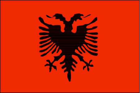
Albania
Pays
Albanie
countryucasefr
ALBANIE
Pays en Chinois
Pays en Espagnol
Albania
Pays en Italien
L'Albania
Pays en Portugais
Albânia
Pays en Allemand
Albanien
countrypy
a1 er3 ba1 ni2 ya4
countrylocal
Shqiperia
countryfull
Albania
countrynm
Albania
ISO2
AL
ISO3
ALB
countrycodeisono
008
countrycodevehicle
AL
countrycodeolympic
ALB
countrycodeirs
AL
countrycodeirsfr
AL
countrycodeirsmixt
AL
♀Féminin
9
6
2
languagesfr
Albanais
5
currency
lek
currencyfr
lek
currencyisocode
ALL
currencyisocodefull
ALL 008
currencypxcode
ALL
currencysymbol
L
currencysubdivision
100 qindarka (qintars)
currencyregime
float
currencyvalue
0.00992
nationality
Albanese
nationalityfr
Albanaise
Capitale
Tirane
capitalfr
Tirana
Préfixe Tél.
355
Superficie km2
28 750
arealand
27 398
areawater
1 350
landarablerate
0.2109
landforestrate
0.362
coastline
362
summit
Korabi 2 764 m.
boundarycountries
Yougoslavie, Grèce, Macedoine
timezonedeltabegin
1
flaglink
maplink
al-map.gif
outlinemaplink
al.gif
visapassenger
-1
maincities
Durrës, Elbasan, Shkodër, Vlorë, Korcë
largestcity
Tirana
largestcitypopulation
270 000
rankpopulation
131
Population
3 169 000
rankgdp
110
gdp
6124000000
rankgdpppp
108
gdpppp
14526000000
rankgni
115
gni
5509000000
rankincomeorigin
120
rankincome
132
income
1740
rankincomeppp
126
incomeppp
4710
lifeexpectation
77.06
alphabetizationrate
0.865
natalityrate
0.01508
mortalityrate
0.00502
mortalityrateinfantile
0.02231
hdi
0.735
urbanization
0.429
nationalevent
Independence Day
nationaleventfr
Jour de l'Indépendance
nationalholiday
28 November (1912)
Date de naissance aaaa-mm-jj
1912-11-28 00:00:00
9
1
location
Southeastern Europe, bordering the Adriatic Sea and Ionian Sea, between Greece and Serbia and Montenegro
terrain
mostly mountains and hills; small plains along coast
naturalresources
petroleum, natural gas, coal, chromium, copper, ti
7
Web
rgbback
16777215
todate
1

2

id
Pays
Pays en Anglais
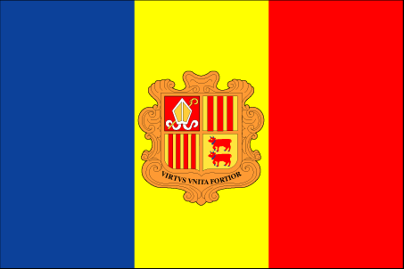
Andorra
Pays
Andorre
countryucasefr
ANDORRE
Pays en Chinois
Pays en Espagnol
Andorra
Pays en Italien
L'Andorra
Pays en Portugais
Andorra
Pays en Allemand
Andorra
countrypy
an1 dao4 er3 shi4
countrylocal
Andorra
countryfull
Andorra
countrynm
Andorra
ISO2
AD
ISO3
AND
countrycodeisono
020
countrycodevehicle
AND
countrycodeolympic
AND
countrycodeirs
AN
countrycodeirsfr
AN
countrycodeirsmixt
AN
countrycode
376
♂Masulin
18
6
32
languagesfr
Catalan
2
currency
euro
currencyfr
eurp
currencyisocode
EUR
currencyisocodefull
EUR 978
currencypxcode
EUR
currencysymbol
currencysubdivision
100 cents
currencyregime
float
currencyvalue
1.2203
nationalityfr
Angolaise
Capitale
Andorra la Vella
capitalfr
Andorre-la-Vieille
Préfixe Tél.
376
Superficie km2
466
arealand
468
landarablerate
0.0222
summit
Coma Pedrosa 2 946 m.
boundarycountries
France, Espagne
timezonedeltabegin
1
flaglink
maplink
an-map.gif
outlinemaplink
ad.gif
visapassenger
-1
maincities
Les Escaldas, Canillo, Encamp, La Massana
largestcity
Andorra-la-Vella
largestcitypopulation
25 000
rankpopulation
196
Population
66 000
rankgni
166
gni
1020000000
rankincomeorigin
41
rankincome
41
income
13600
lifeexpectation
83.51
alphabetizationrate
1
natalityrate
0.009
fecondity
1.26
mortalityrate
0.00607
mortalityrateinfantile
0.00405
growthrate
0.00947
urbanization
0.9333
nationalevent
Our Lady of Meritxell Day
nationaleventfr
Jour de Notre Dame de Meritxell
nationalholiday
8 September (1278)
Date de naissance aaaa-mm-jj
1753-01-01 00:00:00
9
9
location
Southwestern Europe, between France and Spain
terrain
rugged mountains dissected by narrow valleys
naturalresources
hydropower, mineral water, timber, iron ore, lead
1
Web
rgbback
16777215
special
Yes
todate
1

3

id
Pays
Pays en Anglais
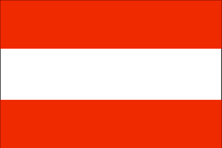
Austria
Pays
Autriche
countryucasefr
AUTRICHE
Pays en Chinois
Pays en Espagnol
Austria
Pays en Italien
L'Austria
Pays en Portugais
Áustria
Pays en Allemand
Österreich
countrypy
ao4 di4 li4
countrylocal
Österreich
countryfull
Austria
countrynm
Austria
ISO2
AT
ISO3
AUT
countrycodeisono
040
countrycodevehicle
A
countrycodeolympic
AUT
countrycodeirs
AU
countrycodeirsfr
AU
countrycodeirsmixt
AU
countrycode
43
♀Féminin
1
7
73
languagesfr
Allemand
2
currency
euro
currencyfr
euro
currencyisocode
EUR
currencyisocodefull
EUR 978
currencypxcode
EUR
currencysymbol
currencysubdivision
100 cents
currencyregime
float
currencyvalue
1.2203
nationalityfr
Autrichienne
Capitale
Vienna
capitalfr
Vienne
Préfixe Tél.
43
Superficie km2
84 000
arealand
82 738
areawater
1 120
landarablerate
0.1689
landforestrate
0.47
summit
Grossglockner 3 797 m.
boundarycountries
Suisse, Liechtenstein, Allemagne, Tchéquie, Slovaquie, Hongrie, Slovénie, Italie.
timezonedeltabegin
1
flaglink
maplink
atcolor.gif
outlinemaplink
atout.gif
maincities
Graz, Linz, Salzburg, Innsbruck, Klagenfurt, Villach, Wels, Steyr, Sankt Pölten.
largestcity
Vienna
largestcitypopulation
2 060 000
rankpopulation
88
Population
8 090 000
rankgdp
20
gdp
253126000000
rankgdpppp
32
gdpppp
243458000000
rankgni
20
gni
216903000000
rankincomeorigin
16
rankincome
12
income
26810
rankincomeppp
12
incomeppp
29740
lifeexpectation
78
alphabetizationrate
0.99
mortalityrateinfantile
0.0044
precipitation
607
nationalevent
National Day
nationaleventfr
Jour National
nationalholiday
26 October (1955)
Date de naissance aaaa-mm-jj
1955-10-26 00:00:00
2
8
location
Central Europe, north of Italy and Slovenia
terrain
in the west and south mostly mountains (Alps); along the eastern and northern margins mostly flat or gently sloping
naturalresources
iron ore, oil, timber, magnesite, lead, coal, lign
5
Web
rgbback
16777215
todate
1

4

id
Pays
Pays en Anglais
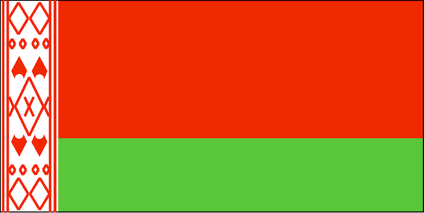
Belarus
Pays
Biélorussie
countryucasefr
BIELORUSSIE
Pays en Chinois
Pays en Espagnol
Belarus
Pays en Italien
Belarus
Pays en Portugais
Belarus
Pays en Allemand
Belarus
countrypy
bai2 e2 luo2 si1
countrylocal
Byelarus
countryfull
Belarus
countrynm
Belarus
ISO2
BY
ISO3
BLR
countrycodeisono
112
countrycodevehicle
BY
countrycodeolympic
BLR
countrycodeirs
BO
countrycodeirsfr
BO
countrycodeirsmixt
BO
♀Féminin
15
4
31
languagesfr
Biélorusse
14
currency
ruble
currencyfr
rouble
currencyisocode
BYR
currencyisocodefull
BYR 112
currencypxcode
BYR
currencysymbol
BR
currencyregime
m.float
Capitale
Minsk
capitalfr
Minsk
Préfixe Tél.
375
Superficie km2
207 600
arealand
207 600
landarablerate
0.2976
landforestrate
0.453
summit
Dzyarzhynskaya Hara 346 m.
boundarycountries
Pologne, Lituanie, Lettonie, Russie, Ukraine
timezonedeltabegin
2
flaglink
maplink
bo-map.gif
outlinemaplink
by.gif
visapassenger
-1
maincities
Gomel, Vitebsk, Brest, Grodno, Mogilev, Bobruysk, Baranovichi, Borisov, Orsha, Pinsk, Mozyr.
largestcity
Minsk
largestcitypopulation
1 784 000
rankpopulation
78
Population
9 881 000
rankgdp
77
gdp
17493000000
rankgdpppp
64
gdpppp
59803000000
rankgni
79
gni
15831000000
rankincomeorigin
121
rankincome
133
income
1600
rankincomeppp
102
incomeppp
6050
lifeexpectation
68.57
alphabetizationrate
1
natalityrate
0.01052
mortalityrate
0.0141
mortalityrateinfantile
0.01362
hdi
0.804
urbanization
0.711
nationalevent
Independence Day
nationaleventfr
Jour de l'Indépendance
nationalholiday
3 July (1944)
Date de naissance aaaa-mm-jj
1944-07-03 00:00:00
1
9
location
Eastern Europe, east of Poland
terrain
generally flat and contains much marshland
naturalresources
forests, peat deposits, small quantities of oil an
7
Web
rgbback
16777215
todate
1

5

id
Pays
Pays en Anglais
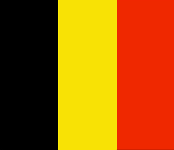
Belgium
Pays
Belgique
countryucasefr
BELGIQUE
Pays en Chinois
Pays en Espagnol
Bélgica
Pays en Italien
Il Belgio
Pays en Portugais
Bélgica
Pays en Allemand
Belgien
countrypy
bi3 li4 shi2
countrylocal
Belgique/Belgie
countryfull
Belgium
countrynm
Belgium
ISO2
BE
ISO3
BEL
countrycodeisono
056
countrycodevehicle
B
countrycodeolympic
BEL
countrycodeirs
BE
countrycodeirsfr
BE
countrycodeirsmixt
BE
countrycode
32
♀Féminin
1
20
7
57
languagesfr
Néerlandais, Français, Allemand
2
currency
euro
currencyfr
euro
currencyisocode
EUR
currencyisocodefull
EUR 978
currencypxcode
EUR
currencysymbol
currencysubdivision
100 cents
currencyregime
float
currencyvalue
1.2203
nationalityfr
Belge
Capitale
Brussels
capitalfr
Bruxelles
Préfixe Tél.
32
Superficie km2
31 100
arealand
30 230
areawater
280
landarablerate
0.25
coastline
66
summit
Signal de Botrange 694 m.
boundarycountries
France, Pays-Bas, Allemagne, Luxembourg
timezonedeltabegin
1
flaglink
maplink
becolor.gif
outlinemaplink
be.gif
maincities
Anvers, Gand, Charleroi, Liège, Bruges, Namur, Mons, Louvain, Alost, Courtrai.
largestcity
Brussels
largestcitypopulation
1 122 000
rankpopulation
73
Population
10 376 000
rankgdp
18
gdp
301896000000
rankgdpppp
28
gdpppp
294001000000
rankgni
18
gni
267250000000
rankincomeorigin
20
rankincome
16
income
25760
rankincomeppp
14
incomeppp
28920
lifeexpectation
78.13
alphabetizationrate
0.99
natalityrate
0.0106
mortalityrate
0.01008
mortalityrateinfantile
0.00464
nationalevent
Ascension to the Throne of King Leopold I
nationaleventfr
Ascension au Tronc du Roi Léopold I
nationalholiday
21 July (1831)
Date de naissance aaaa-mm-jj
1831-06-21 00:00:00
8
4
location
Western Europe, bordering the North Sea, between France and the Netherlands
terrain
flat coastal plains in northwest, central rolling hills, rugged mountains of Ardennes Forest in southeast
naturalresources
coal, natural gas
cooking
Bonbons.
4
Web
rgbback
16777215
todate
1
Notes
Bonbons.

Plus+
A | B | C | D | E | F | G | H | I | J | K | L | M | N | O | P | Q | R | S | T | U | V | W | X | Y | Z
 

Envoyez vos commentaires (37)

37. Visiteur *.*.164.* - 2022-03-16 17:43:29
Buenas recomendaciones y todo lo que lleva el contenido de la web es increíble!
36. Visiteur *.*.222.* - 2022-02-09 12:45:33
Los materiales que se utilizan para realizar este tipo de prácticas están todos hechos de madera!
35. Visiteur *.*.225.* - 2022-01-24 16:55:06
Buenas ideas sabemos como podemos inspirarnos gracias a links así!
34. Visiteur *.*.32.* - 2022-01-19 19:32:41
Los sitios web de esta manera me inspiran a seguir trabajando duro!
33. Visiteur *.*.146.* - 2021-11-26 15:19:37
Excellent information on your content, thank you for taking the time to share with us.
Email Web

Veuillez recopier la chaîne :
Texte à recopier.

Asia Home™ > Indonésie > Albanie 阿尔巴尼亚 => Indonésie 印度尼西亚 => Pays de Beau Bois | Conditions générales de vente | Retours et remboursements | Clauses de Confidentialité | FAQ
  

Envie de venir ? | Appelez-nous 7/704 67 79 04 87 (Service Epices)

Fêtes    Fermer
Joyeuse Toussaint : Vendredi 1er Novembre, Asia Home™ sera ouvert de 9:00 à 0, vous viendrez ? Horaires
 
Fenêtre contextuelle    Fermer
Veuillez patienter...