印度尼西亚 Indonesia => 一个盛产木材的国家
印度尼西亚 Indonesia => 一个盛产木材的国家
 艺人 |
 印度尼西亚家具精选 |
 小物件 |
 印度尼西亚家具演变史 |
印度尼西亚 Indonesia => 一个盛产木材的国家
最后修正 2023-11-09 09:24:11
印度尼西亚是一个地处亚洲的国家, 首都/首府是雅加达 。 它的行政划分如下: 印度尼西亚 被划分成 省, 然后又被细划分成 县 (kabupaten),市 (kota), 然后又被细划分成 区, 然后又被细划分成 乡,镇,村.
在此您可以得到世界各国和地区的法文,英文,中文名称。 这个珍贵的全人类共享的土地的集合,不仅包括世界上的独立国家, 而且也包括非联合国联合国:我联合国人民,团结起来追求更美好的世界!会员国的特殊领域。 请咨询 法语国名/地区名阴阳性详表。
1
id
国家/地区
英语国家/地区名
Namibia
法语国家/地区名
Namibie
countryucasefr
NAMIBIE
国家/地区名
西班牙语国家/地区名
Namibia
意大利语国家/地区名
Il Namibia
葡萄牙语国家/地区名
Namíbia
德语国家/地区名
Namibia
countrypy
na4 mi3 bi3 ya4
countrylocal
Namibia
countryfull
Namibia
countrynm
Namibia
国际编码2
NA
国际编码3
NAM
countrycodeisono
516
countrycodevehicle
NAM
countrycodeolympic
NAM
countrycodeirs
WA
countrycodeirsfr
WA
countrycodeirsmixt
WA
♀女性
15
4
1
languagesfr
Afrikaans, allemand, anglais
72
currency
dollar
currencyfr
rand
currencyisocode
NAD
currencyisocodefull
NAD 516
currencypxcode
NAD
currencysymbol
N$
currencysubdivision
100 cents
currencyregime
South African Rand (1.0)
currencyvalue
0.1457
nationalityfr
Namibienne
首都
Windhoek
capitalfr
Windhoek
电话号码前缀
264
面积 km2
825 418
arealand
825 418
landarablerate
0.0099
landforestrate
0.098
coastline
1572
summit
Konigstein 2 606 m.
boundarycountries
Angola, Zambie, Afrique du Sud, Botswana.
timezonedeltabegin
2
flaglink
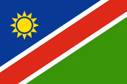
maplink
nacolor.gif
outlinemaplink
naout.gif
visapassenger
-1
maincities
Walvis Bay, Tsumeb, Lüderitz, Keetmanshoop, Otjiwarongo, Swakopmund.
largestcity
Windhoek
largestcitypopulation
190 000
rankpopulation
141
人口
2 015 000
rankgdp
124
gdp
4271000000
rankgdpppp
117
gdpppp
12450000000
rankgni
132
gni
3883000000
rankincomeorigin
112
rankincome
122
income
1930
rankincomeppp
95
incomeppp
6660
lifeexpectation
42.77
alphabetizationrate
0.814
natalityrate
0.0341
mortalityrate
0.01917
mortalityrateinfantile
0.06844
hdi
0.601
nationalevent
Independence Day
nationaleventfr
Jour de l'Indépendance
nationalholiday
21 March (1990)
生日 年-月-日
1990-03-21 00:00:00
7
7
location
Southern Africa, bordering the South Atlantic Ocean, between Angola and South Africa
terrain
mostly high plateau; Namib Desert along coast; Kalahari Desert in east
naturalresources
diamonds, copper, uranium, gold, lead, tin, lithiu
9
网站
rgbback
16777215
todate
1
2
id
国家/地区
英语国家/地区名
Nauru
法语国家/地区名
Nauru
countryucasefr
NAURU
国家/地区名
西班牙语国家/地区名
Nauru
意大利语国家/地区名
Il Nauru
葡萄牙语国家/地区名
Nauru
德语国家/地区名
Nauru
countrypy
nao4 lu3
countrylocal
Nauru
countryfull
Nauru
countrynm
Nauru
国际编码2
NR
国际编码3
NRU
countrycodeisono
520
countrycodevehicle
NAU
countrycodeolympic
NRU
countrycodeirs
NR
countrycodeirsfr
NR
countrycodeirsmixt
NR
♂男性
15
6
186
languagesfr
Nauru
10
currency
dollar
currencyfr
dollar australien
currencyisocode
AUD
currencyisocodefull
AUD 036
currencypxcode
AUD
currencysymbol
A$
currencysubdivision
100 cents
currencyregime
float
currencyvalue
0.7485
首都
Yaren District
capitalfr
Yaren
电话号码前缀
674
面积 km2
21
arealand
21
coastline
30
summit
61 m.
timezonedeltabegin
12
flaglink
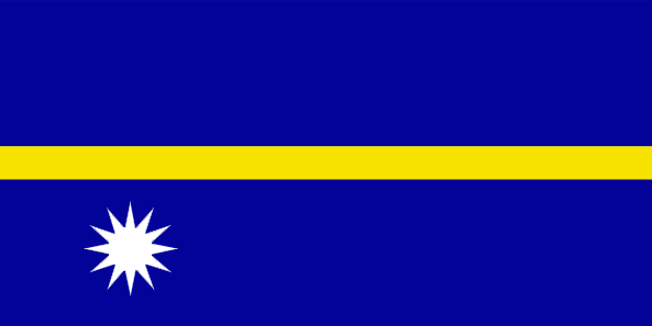
maplink
nrcolor.gif
outlinemaplink
nr.gif
visapassenger
-1
maincities
Anabar, Anibare, Anna, Ijuw, Uaboe, Yangor.
largestcity
Yaren District
largestcitypopulation
10 000
rankpopulation
220
人口
12 809
rankgni
205
gni
140000000
rankincomeorigin
48
rankincome
52
income
11667
lifeexpectation
62.33
natalityrate
0.02561
mortalityrate
0.00695
mortalityrateinfantile
0.01014
urbanization
1
nationalevent
Independence Day
nationaleventfr
Jour de l'Indépendance
nationalholiday
31 January (1968)
生日 年-月-日
1968-01-31 00:00:00
5
9
location
Oceania, island in the South Pacific Ocean, south of the Marshall Islands
terrain
sandy beach rises to fertile ring around raised coral reefs with phosphate plateau in center
naturalresources
phosphates, fish
9
rgbback
16777215
todate
1
3
id
国家/地区
英语国家/地区名
Nepal
法语国家/地区名
Népal
countryucasefr
NEPAL
国家/地区名
西班牙语国家/地区名
Nepal
意大利语国家/地区名
Il Nepal
葡萄牙语国家/地区名
Nepal
德语国家/地区名
Nepal
countrypy
ni2 bo2 er3
countrylocal
Nepal
countryfull
Nepal
countrynm
Nepal
国际编码2
NP
国际编码3
NPL
countrycodeisono
524
countrycodevehicle
NEP
countrycodeolympic
NEP
countrycodeirs
NP
countrycodeirsfr
NP
countrycodeirsmixt
NP
♂男性
18
6
107
languagesfr
Nepali
73
currency
rupee
currencyfr
roupie népalaise
currencyisocode
NPR
currencyisocodefull
NPR 524
currencypxcode
NPR
currencysymbol
NRs
currencysubdivision
100 paise
currencyregime
composite
currencyvalue
0.01505
nationalityfr
Népalaise
首都
Kathmandu
capitalfr
Katmandou
电话号码前缀
977
面积 km2
140 791
arealand
136 800
areawater
4 000
landarablerate
0.2027
landforestrate
0.273
summit
Everest 8 850 m.
boundarycountries
Inde, Chine.
timezonedeltabegin
5.75
flaglink
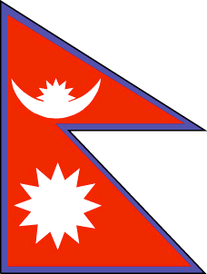
maplink
npcolor.gif
outlinemaplink
npout.gif
visapassenger
-1
maincities
Sallyana, Patan, Jumla, Biratnagar, Lalitpur, Bhaktapur, Pokhara.
largestcity
Kathmandu
largestcitypopulation
533 000
rankpopulation
44
人口
24 660 000
rankgdp
113
gdp
5851000000
rankgdpppp
78
gdpppp
35015000000
rankgni
113
gni
5868000000
rankincomeorigin
192
rankincome
206
income
240
rankincomeppp
179
incomeppp
1420
lifeexpectation
59
alphabetizationrate
0.3816
natalityrate
0.03246
mortalityrate
0.00984
mortalityrateinfantile
0.07057
hdi
0.49
nationalevent
Birthday of King GYANENDRA
nationaleventfr
Anniversaire du Roi GYANENDRA
nationalholiday
7 July (1946)
生日 年-月-日
1946-07-07 00:00:00
3
11
location
Southern Asia, between China and India
terrain
Terai or flat river plain of the Ganges in south, central hill region, rugged Himalayas in north
naturalresources
quartz, water, timber, hydropower, scenic beauty,
cooking
Encens spirituels.
9
rgbback
16777215
todate
1
小注
Encens spirituels.
4
id
国家/地区
英语国家/地区名
Nicaragua
法语国家/地区名
Nicaragua
countryucasefr
NICARAGUA
国家/地区名
西班牙语国家/地区名
Nicaragua
意大利语国家/地区名
La Nicaragua
葡萄牙语国家/地区名
Nicarágua
德语国家/地区名
Nicaragua
countrypy
ni2 jia1 la1 gua1
countrylocal
Nicaragua
countryfull
Nicaragua
countrynm
Nicaragua
国际编码2
NI
国际编码3
NIC
countrycodeisono
558
countrycodevehicle
NIC
countrycodeolympic
NCA
countrycodeirs
NU
countrycodeirsfr
NU
countrycodeirsmixt
NU
countrycode
505
♂男性
15
6
131
languagesfr
Espagnol
76
currency
gold cordoba
currencyfr
cordoba
currencyisocode
NIO
currencyisocodefull
NIO 558
currencypxcode
NIO
currencysymbol
C$
currencysubdivision
100 centavos
currencyregime
indicators
currencyvalue
0.06146
nationalityfr
Nicaraquaïenne
首都
Managua
capitalfr
Managua
电话号码前缀
505
面积 km2
129 494
arealand
120 254
areawater
9 240
landarablerate
0.2024
landforestrate
0.27
coastline
910
summit
Cerro Mogotón 2 438 m
boundarycountries
Honduras, Costa Rica.
timezonedeltabegin
-5
flaglink
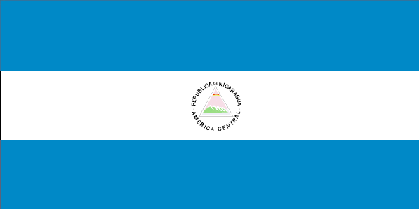
maplink
nicolor.gif
outlinemaplink
nioutl.gif
visapassenger
-1
maincities
Rosita, León, Granada, Masaya, Chinandega, Matagalpa, San Carlos, Estelí, Jinotepe .
largestcity
Managua
largestcitypopulation
1 124 000
rankpopulation
103
人口
5 480 000
rankgdp
127
gdp
4083000000
rankgdpppp
102
gdpppp
17877000000
rankgni
127
gni
4082000000
rankincomeorigin
148
rankincome
162
income
740
rankincomeppp
143
incomeppp
3180
lifeexpectation
70
alphabetizationrate
0.672
natalityrate
0.02558
mortalityrate
0.00463
mortalityrateinfantile
0.03025
hdi
0.643
urbanization
0.565
precipitation
1147
nationalevent
Independence Day
nationaleventfr
Jour de l'Indépendance
nationalholiday
15 September (1821)
生日 年-月-日
1821-09-15 00:00:00
8
6
location
Middle America, bordering both the Caribbean Sea and the North Pacific Ocean, between Costa Rica and Honduras
terrain
extensive Atlantic coastal plains rising to central interior mountains; narrow Pacific coastal plain interrupted by volcanoes
naturalresources
gold, silver, copper, tungsten, lead, zinc, timber
9
网站
rgbback
16777215
todate
1
5
id
国家/地区
英语国家/地区名
Niger
法语国家/地区名
Niger
countryucasefr
NIGER
国家/地区名
西班牙语国家/地区名
Niger
意大利语国家/地区名
Il Niger
葡萄牙语国家/地区名
Niger
德语国家/地区名
Niger
countrypy
ni2 ri4 er3
countrylocal
Niger
countryfull
Niger
countrynm
Niger
国际编码2
NE
国际编码3
NER
countrycodeisono
562
countrycodevehicle
RN
countrycodeolympic
NIG
countrycodeirs
NG
countrycodeirsfr
NG
countrycodeirsmixt
NG
♂男性
15
6
57
languagesfr
Français
119
currency
franc
currencyfr
franc C.F.A.
currencyisocode
XOF
currencyisocodefull
XOF 952
currencypxcode
XOF
currencysymbol
CFAF
currencysubdivision
100 centimes
currencyregime
Euro (655.957)
currencyvalue
0.00186
nationalityfr
Nigérienne
首都
Niamey
capitalfr
Niamey
电话号码前缀
227
面积 km2
1 267 000
arealand
1 266 700
areawater
300
landarablerate
0.0394
landforestrate
0.01
summit
Mont Gréboun 1 944 m.
boundarycountries
Burkina Faso, Mali, Algérie, Libye, Tchad, Nigeria, Bénin.
timezonedeltabegin
1
flaglink
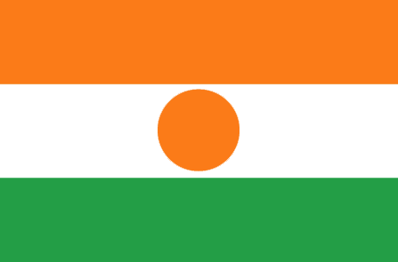
maplink
necolor.gif
outlinemaplink
neout.gif
visapassenger
-1
maincities
Zinder, Maradi, Tahoua, Birni n'Konni, Agadez, Filigué, Dosso.
largestcity
Niamey
largestcitypopulation
587 000
rankpopulation
66
人口
11 762 000
rankgdp
137
gdp
2731000000
rankgdpppp
125
gdpppp
9818000000
rankgni
148
gni
2382000000
rankincomeorigin
197
rankincome
211
income
200
rankincomeppp
195
incomeppp
830
lifeexpectation
42.18
alphabetizationrate
0.172
natalityrate
0.04891
mortalityrate
0.02151
mortalityrateinfantile
0.12266
hdi
0.292
urbanization
0.211
nationalevent
Republic Day
nationaleventfr
Jour de la République
nationalholiday
18 December (1958)
生日 年-月-日
1958-12-18 00:00:00
5
11
location
Western Africa, southeast of Algeria
terrain
predominately desert plains and sand dunes; flat to rolling plains in south; hills in north
naturalresources
uranium, coal, iron ore, tin, phosphates, gold, pe
9
网站
rgbback
16777215
todate
1
